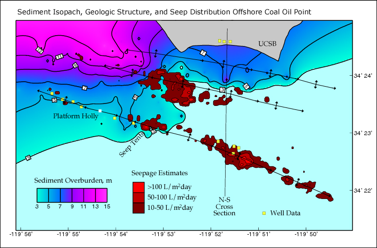
Isopach is a line that connects points of equivalent thickness of a geologic formation on a map. Isopach map illustrates thickness variations in a layer or tabular unit. In this map, the contour describes the overburden sediment of the ocean floor. The legend represents green transition into pink to show the progression of the thickness. As the pink increases, the greater the thickness. Seasonal changes in currents and waves causes the 3 meter differences in sediment overburden thickness.
No comments:
Post a Comment