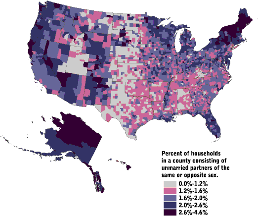
A statistical map work with government census data to plot the variation in the quantity of the information in the indicated geographic area. It could be any kind of information such as ethnicity, income, housing, so that these maps can identify patterns and trends across the country or whatever parameters that is desired. Statistical maps uses color and symbols such as this map showing unmarried partners in the United States. Viewers can gather that the largest population in the US that's unmarried lives in Menominee County, Wiscinson (4.6%). In general, this map shows that that unmarried households are a small percentage of U.S. households.
No comments:
Post a Comment